Best cycling apps for planning rides based on the forecast (2026)
Five route-specific cycling weather apps compared — from Tailwind GPS's hourly scores to myWindsock's power analysis. Find the right tool for how you actually ride.

You've got a two-hour window on Saturday morning. The forecast says 'partly cloudy', which tells you almost nothing. Will the wind be on your nose for the first 20km or pushing you home? Is the rain arriving at 10am or noon? Generic weather apps won't answer any of that. Route-specific cycling weather apps will.
This guide covers the five best apps for planning rides based on the forecast, explains what each does well, and gives you a clear decision checklist so you can pick the right one for how you actually ride. For a deeper dive into three of the main wind-aware contenders, see our wind-aware cycling apps compared guide.
Quick answer: which app is genuinely the best?
If you ride regular loops and want to know the single best hour to leave, Tailwind GPS is the strongest option for most recreational and club cyclists. It converts wind, temperature and rainfall along your exact route into a single 0–100 score per departure hour, updated continuously up to 14 days ahead. The free tier covers 3 routes and a 3-day forecast, so you can test it on the loops you already ride before spending a penny.
For performance-focused riders who want power-impact wind charts, myWindsock goes deeper on analytics. For route discovery with a weather layer, Komoot Premium adds conditions along your route — but for scoring your regular loops and picking the best departure hour, Tailwind GPS is the clearer choice. The full breakdown is below.
Why generic weather apps fail cyclists (particularly with wind)
Here's the problem: a southwest wind at 25 km/h sounds manageable. But if your favourite loop heads southeast for the first half and then loops back northwest, that same wind could mean a brutal crosswind outbound and a direct headwind home. The forecast on your phone has no idea your route does that.
A postcode forecast gives you one data point. Your route passes through dozens of them, at different headings, over different terrain, at different times as you move along it. The gap between 'what the weather is doing' and 'what the ride will actually feel like' is where cycling-specific weather apps earn their place.
Wind is the worst offender. Temperature and rain are roughly consistent across a short loop. Wind direction relative to your route heading changes constantly on any loop or out-and-back ride, which means the only useful wind forecast is one that follows your actual line.
What to look for in a route forecast cycling app
Before getting into the individual apps, here's the checklist that separates genuinely useful tools from glorified weather widgets:
- Route-specific forecast, wind, rain and temperature sampled along your actual route line, not just a point forecast for your postcode.
- Time-aware guidance, a 'best departure hour' recommendation, not just 'here's tomorrow's weather'.
- Personalisation, your riding pace changes your ETA at every segment and therefore your wind exposure. Apps that factor in your actual speed give better recommendations.
- Usability, quick to check, easy to import routes (GPX or Strava), and readable on a phone screen.
- Alerts and planning window, cycling weather alerts and a longer forecast horizon (7 to 14 days) are genuinely useful for planning ahead.
With that framework in mind, here are the five apps worth your time.
1. Tailwind GPS, best for 'what's the right hour to leave?'
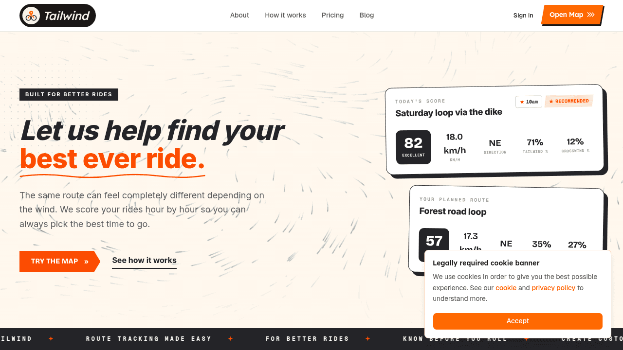
What it does: Tailwind GPS analyses wind direction and speed, temperature and precipitation along every segment of your route, then distils all of that into a single Tailwind Score (0–100) for each departure hour. The mission is simple: find the right loop at the right hour.
The score bands give you instant context:
- 80–100: excellent conditions
- 60–79: good
- 40–59: fair
- 20–39: tough
- 0–19: brutal
You scroll through departure hours, watch the score move, and pick your window. It doesn't require a meteorology degree.
How personalisation works: Connect Strava and Tailwind uses your typical riding pace from your activity history to calculate your ETA at each route segment. That matters because a faster rider hits the exposed hilltop 20 minutes earlier than a slower one, and the wind may have shifted by then. Generic 'average cyclist' assumptions can mislead you; pace-specific modelling won't.
Getting started in 3 steps:
- Connect your Strava account (or upload a GPX file, or draw a route on the interactive map).
- Select a route and scroll through departure hours to find your best Tailwind Score window.
- Start free (up to 3 routes, 3-day forecast), then upgrade for the full 14-day planning window, up to 40 routes, weekly summary emails and per-route cycling weather alerts at $2.99/month or $19.99/year.
Best for: Everyday riders who repeat familiar loops and want a fast, low-friction answer to 'when should I leave today?'
Trade-off: Tailwind is focused on timing and conditions rather than route discovery. If you want to plan entirely new routes from scratch with elevation-led navigation, you'd pair it with a route builder.
2. Epic Ride Weather, best for Strava and Garmin users who want minute-by-minute detail
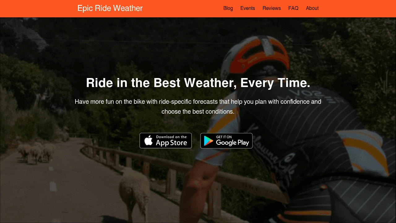
What it does: Epic Ride Weather provides route-specific forecasts showing wind, rain and temperature along your route, minute by minute. It integrates with Strava, Garmin and Komoot, and according to Ride with GPS support documentation (April 2026), it generates forecasts tailored to a specific route, speed, riding date and time. It's used by pro teams for ride-day forecasting — useful context, though for scoring your regular route library and picking departure hours across a two-week window, Tailwind GPS is the more practical daily tool.
Best for: Riders deeply embedded in the Strava/Garmin ecosystem who want detailed route weather with strong mobile app support.
Trade-off: Pricing detail isn't front-and-centre on the main page, which makes plan comparison harder before you commit. The methodology behind the minute-by-minute model also isn't explained in accessible terms for new users evaluating the app.
3. myWindsock, best for performance and power-impact wind analysis
What it does: myWindsock uses on-road wind modelling to give you head/tailwind breakdowns, power and resistance-style outputs, and a comprehensive route planner. The feature catalogue is extensive. If you want to model how a 15 km/h headwind translates into extra watts over a 60km route, myWindsock is the tool for that.
Best for: Data-driven, performance-oriented riders (time triallists, racers, sportive planners) who want engineering-style wind analysis rather than a quick score.
Trade-off: The depth of data can be overwhelming for casual riders. New visitors often encounter a metric-heavy interface without much guidance on how to interpret what they're seeing, and the product isn't particularly optimised for quick 'what time should I leave?' checks.
4. Headwind, best for Strava-based difficulty heatmaps
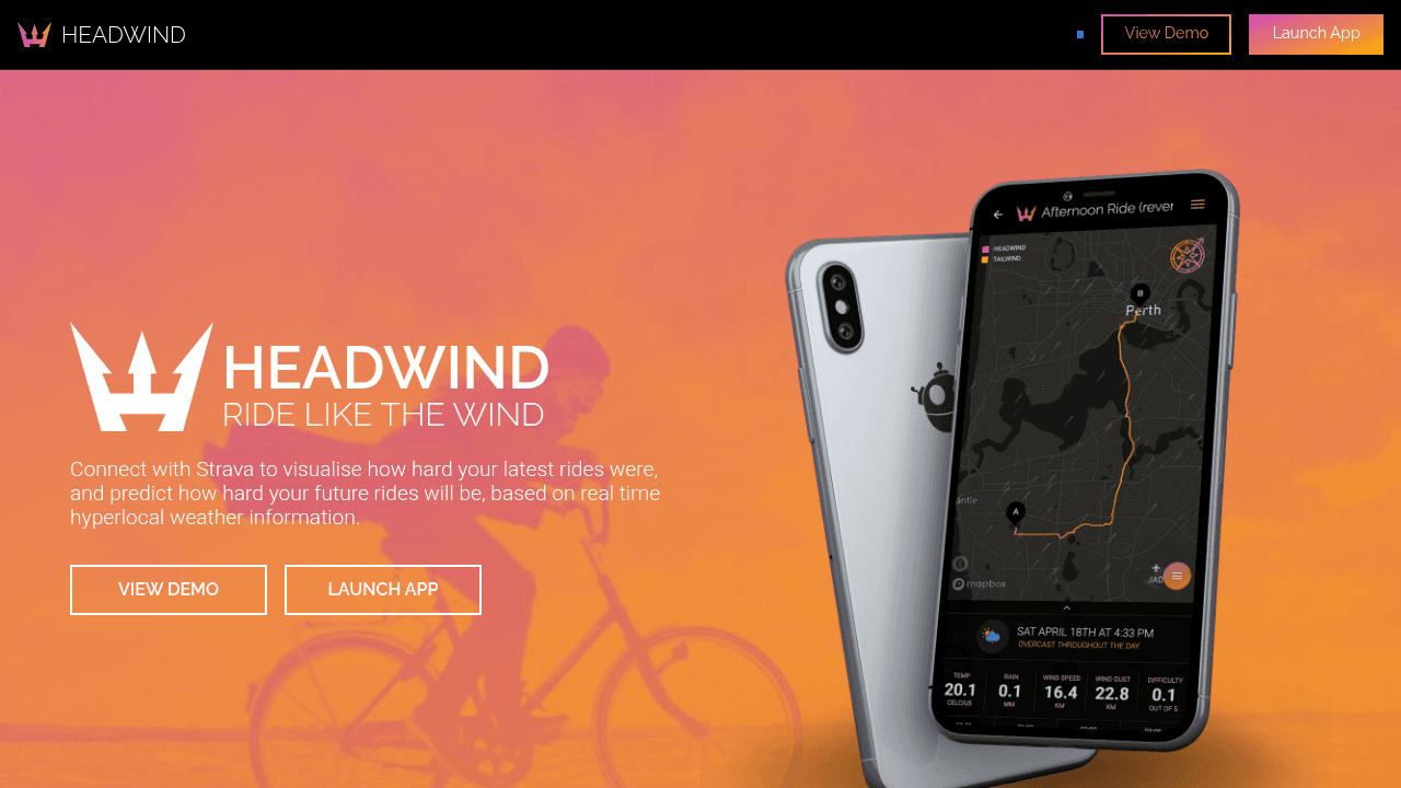
What it does: Headwind integrates with Strava to overlay hyperlocal wind data onto your routes and produce difficulty heatmaps, showing you which segments will be hard based on wind direction. It uses weather data sources including Dark Sky and RainViewer. The visual presentation, with colour-coded heatmaps of ride difficulty, is one of the cleaner UX approaches in the category.
Best for: Strava users who want to visualise wind-driven difficulty across their regular routes and understand which parts of a ride will be hardest before they leave.
Trade-off: Pricing and free-vs-paid feature clarity are thin on the main page. The scoring methodology isn't well explained, so it's hard to judge accuracy or understand what inputs drive the difficulty rating.
5. Komoot Premium weather layer, best for all-in-one route discovery with on-route weather
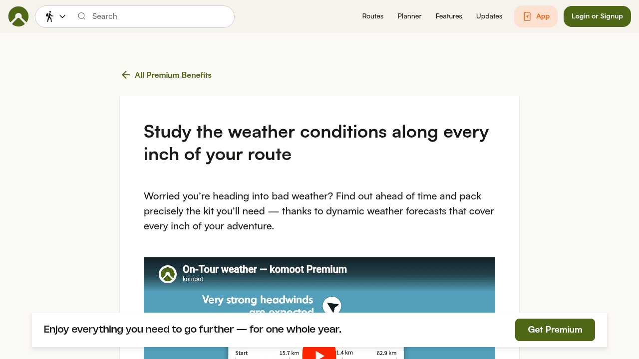
What it does: Komoot Premium adds dynamic weather forecasts to its route planning and navigation platform, with the marketing promise of 'weather conditions along every inch of your route'. If you're already a Komoot user who plans routes for touring, gravel riding or trail exploration, the weather layer slots neatly into the experience.
Best for: Route discovery-focused riders who want weather integrated into a planning and navigation tool rather than a standalone weather app.
Trade-off: The weather layer is thin on explanatory content. There's limited guidance on how to interpret the forecast for timing decisions, and no standalone FAQ or methodology section. For serious wind and departure-time planning, dedicated tools like Tailwind GPS or myWindsock go considerably deeper.
Side-by-side comparison
| App | Primary focus | Route-specific forecast | Departure time guidance | Strava integration | Free tier | Planning window |
|---|---|---|---|---|---|---|
| Tailwind GPS | Best hour, best route (0–100 score) | Yes, per segment, hourly | Yes, score per departure hour | Yes (pace personalisation) | Yes (3 routes, 3-day) | Up to 14 days (paid) |
| Epic Ride Weather | Minute-by-minute route forecast | Yes | Yes | Yes | App download required | Not published |
| myWindsock | Performance wind analysis | Yes | Yes | Yes | Limited | Not published |
| Headwind | Difficulty heatmaps | Yes | Partial | Yes | Yes | Limited |
| Komoot Premium | Route planning + weather layer | Yes | Limited | Yes | No (Premium plan) | Not published |
Common questions about route forecast cycling apps
Does a route-specific forecast replace a standard weather app? No. General weather apps are still useful for a broad picture (is a storm coming?). Route-specific tools are better for the decision that matters to cyclists: should I leave at 7am or 9am, and which direction should I ride?
How far ahead can Tailwind GPS plan? The free tier covers 3 days. Paid subscribers get a full 14-day cycling forecast with wind scores, which is genuinely useful for planning a club ride or weekend sportive earlier in the week.
What does the Tailwind Score actually include? The score is built from wind direction and speed sampled along each route segment, plus temperature and precipitation, all tied to your departure hour. It's not a single-point forecast. It samples conditions as you'd actually encounter them moving along the route at your pace.
Do I need a Strava account to use Tailwind GPS? No. You can upload a GPX file or draw a custom route on the interactive map. Strava is optional, but connecting it lets Tailwind use your typical riding pace to personalise departure time recommendations, which meaningfully improves accuracy.
Are cycling weather alerts only for paid subscribers? Per-route email alerts and weekly summary emails are subscriber features. Free users can still check scores manually at any time within the 3-day window.
How accurate are route-specific forecasts? No forecast is guaranteed. Weather model accuracy degrades beyond 5–7 days for any tool. What route-specific modelling improves is relevance, not precision. Knowing wind will be from the southwest at 20 km/h is more useful when you can see exactly which segments of your route face into it.
Can Tailwind GPS help with headwind training? Yes. Beyond 'find the easiest conditions', Tailwind also supports training-focused use. If you want a hard session, you can deliberately target departure windows where headwind exposure on your chosen loop is highest.
Which app should you choose?
- You ride the same loops most weeks and want a fast 'best hour' answer: Tailwind GPS. Start free on 3 routes, see the score in action, upgrade when the 14-day window becomes useful.
- You're a performance cyclist who wants power-impact wind modelling: myWindsock. It's the most data-rich option for engineering-style analysis.
- You want to see wind-driven difficulty coloured across your Strava routes: Headwind. The heatmap format is intuitive and it's Strava-native.
- You want a single app for route planning, navigation and weather: Komoot Premium. The weather layer is a bonus on top of its excellent route planning tools.
- You're on Strava and Garmin and want minute-by-minute route forecasts: Epic Ride Weather. The Visma | Lease a Bike association speaks to its pedigree with performance riders.
For most recreational cyclists who ride familiar routes, the gap between 'checking the weather' and 'knowing the right time to leave' is exactly what Tailwind GPS is built to close.
Try it on your next ride
Start with the free tier at Tailwind GPS. Add up to 3 routes (connect Strava or upload a GPX), check the Tailwind Score across today and the next two days, and see whether the number matches your gut feel about conditions. Most riders find it changes when they leave within the first week of using it.
When the 14-day planning window, alerts and full 40-route library start to feel necessary, that's when the subscription at $2.99/month earns itself quickly.
Try it now
Open the interactive wind map and score your regular routes — no sign-up required.
Related posts
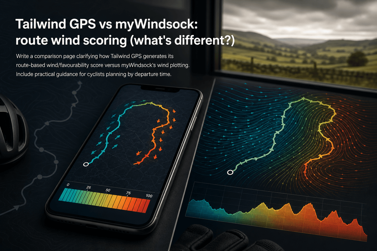
Tailwind GPS vs myWindsock: route wind scoring (what's different?)
How Tailwind GPS's 0–100 route wind score differs from myWindsock's Air Penalty scoring — and which to use for departure timing vs performance analysis.
·10 min read

Strava route planner vs wind-aware planning
Strava is genuinely excellent at route planning. The heatmap alone has probably sent millions of cyclists down roads they'd never have found otherwise. But if you've ever glanced at the forecast before a Saturday club run, set off into a gentle-looking 15 km/h wind, and spent the final 30 km g...
·8 min read

Tailwind GPS vs Epic Ride Weather vs myWindsock
Three apps. All promising to tell you how wind will affect your ride. But they solve very different problems, and choosing the wrong one wastes time, money, and possibly a Saturday morning into a 30 mph headwind.
·9 min read