Best route planner for cyclists in 2026: stop guessing, start scoring
You've checked the weather. The app says 18 mph winds from the west. Fine, but is that a tailwind for the first half and a brutal headwind home, or the other way round? Generic forecasts don't answer that. Your actual route heading does.
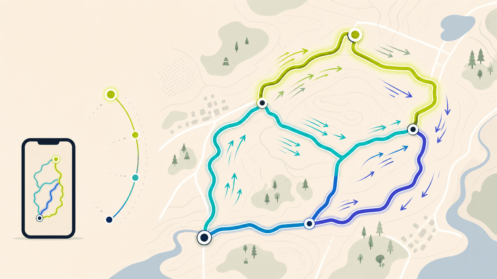
You've checked the weather. The app says 18 mph winds from the west. Fine, but is that a tailwind for the first half and a brutal headwind home, or the other way round? Generic forecasts don't answer that. Your actual route heading does.
That's the real problem with most cycling route planners: they'll help you draw the ride, but they won't tell you when to go. So here's a straight answer to the question, followed by a full breakdown so you can make the call yourself.
The best route planner for cyclists depends on what you're trying to optimise. If it's discovery and navigation, that's one answer. If it's wind-aware start-time planning on routes you already ride, that's a different one entirely.
This article covers all of it, with a recommendation for each rider type.
The four things cyclists actually want from a route planner
Most route planning needs fall into one of four buckets:
- Plan and navigate, draw a route, get turn-by-turn, arrive safely.
- Discover new rides, find routes other people have ridden in a new area.
- Track fitness and history, log rides, analyse segments, compare performances.
- Optimise for wind and conditions, choose the best departure time for a route you already know.
The mistake most riders make is using one tool for all four. A few apps genuinely cover multiple bases, but none does everything equally well. Know your priority and you'll immediately narrow the field.
Quick comparison: what each category does best
| Category | Best option(s) | Choose this if... |
|---|---|---|
| Route creation and discovery | komoot | You're exploring a new area and want curated, sport-specific suggestions |
| Route library and activity tracking | Strava | You want to log rides, find segments, and tap into a large community |
| Mapping and navigation hub | Ride with GPS | You need advanced map layers and strong GPX/integration workflows |
| Route-weather overlays | Epic Ride Weather, myWindsock | You want hyper-localised forecasts layered onto a specific route |
| Wind-aware timing score | Tailwind GPS | You ride the same loops and want a single score that tells you the best hour to leave |
The 7 features that actually matter in a cycling route planner
Before picking an app, run it against this checklist. Most riders only discover what they're missing after a bad ride.
1. Route creation vs discovery vs navigation
These are three separate things. Creating a route means drawing your own A-to-B or loop. Discovery means browsing what others have ridden. Navigation means turn-by-turn guidance on the bike. Some apps do all three; most do one or two well.
2. GPX import and export, plus shareable links
If you ride with a Garmin, Wahoo, or similar device, you need GPX files. If you organise club rides, you need shareable links. Not every planner makes this easy, check before you commit.
3. Offline maps
For rural rides or areas with patchy signal, offline capability matters. Komoot lets you download routes and maps for offline use from Profile > Saved Routes (per their May 2026 support documentation). If you're regularly in low-signal terrain, this is non-negotiable.
4. Route-specific weather, not doorstep weather
This is the big one. Knowing the wind speed at your house tells you almost nothing useful. A westerly at 20 mph is a tailwind on one leg of your loop and a headwind on the return. Route-specific weather for cycling means sampling conditions along every segment of your actual route, not just at a single pin.
5. Start-time planning
The best departure time for a route can shift by hours depending on how the wind changes through the day. An app that lets you scroll through hourly forecasts for a specific route is categorically more useful than one that shows a daily summary.
6. Personalisation by pace
Your speed determines where you'll be on the route at any given moment. A forecast that assumes average rider speed can put you in the wrong place at the wrong time. Pace-aware scoring, ideally pulled from your actual Strava history, gives you a meaningfully more accurate picture.
7. Alerts and automation
If you're checking weather apps every morning, you're wasting time. The best tools watch conditions for you and send an alert when your favourite route hits a score you care about. This turns a planning chore into a background process.
Best picks by rider type
Everyday repeat-loop rider
You do the same three or four routes. You just want to know which morning is worth getting out of bed early. Tailwind GPS is built for this. Connect Strava and your routes appear automatically, each with an hourly Tailwind Score and a recommended best departure time. The free tier covers 3 routes with a 3-day forecast; subscribers get up to 40 routes and a 14-day window for $2.99/month or $19.99/year.
Club or ride organiser
You need to share routes and get everyone on the same page before Sunday morning. Tailwind GPS lets you share route links with a time-specific score attached, and supports GPX download for members who want to load the route onto their head unit. Komoot and Ride with GPS also handle GPX workflows well if discovery is your primary goal. See the Tailwind GPS approach to club ride planning for a practical walkthrough.
Short familiar loops
You probably don't need a sophisticated route builder — you know the roads. What you do need is quick, reliable rain and wind timing so a short weekday spin doesn't turn into a soaking. A lightweight planner with fast forecast access is more valuable here than a full route library.
Gravel and adventure rider
You're somewhere new, you want route inspiration, and you need offline maps when the signal drops. Komoot covers discovery and offline navigation; use Tailwind GPS alongside it to pick the best day and departure time for the route you settle on.
Multi-day and touring cyclist
Complex route planning with multiple waypoints, overnight stops, and exportable files tends to suit Ride with GPS-style workflows. Their Wind map layer uses NOAA-derived data updated twice daily to show wind direction along a route, useful, though it's a layer rather than a scored decision.
On-bike navigation priority
If you want the best turn-by-turn experience on a Garmin Edge device, Garmin's own ecosystem does that well. The gap is that Garmin Edge weather overlays for wind planning typically require additional Connect IQ apps and don't give you a single departure-time score for your route. You'd want to pair the device with a dedicated wind-aware cycling route planner for that layer.
Why generic weather fails cyclists
Picture a 50 km loop. The wind is blowing from the south-west at 18 mph. The first 15 km heads roughly north, that's a crosswind, manageable. The next 10 km turns east, now you've got a partial tailwind. The return leg runs south-west back to home, full headwind for the last 25 km. The weather app says 18 mph winds. That's technically true and completely useless.
Headwinds and tailwinds only make sense relative to your direction of travel at each point on the route. A westerly wind is a tailwind going east and a headwind going west. On a loop, you'll experience both, and the proportion matters enormously for how the ride feels.
Tailwind GPS addresses this by sampling wind direction and speed along every segment of your route, factoring in temperature and precipitation, and calculating how much of the ride will be headwind, tailwind, and crosswind. That analysis runs for every departure hour, so you can see not just whether today is good but which hour today is best.
Tailwind GPS in depth: Score, forecast window, and Strava sync
The Tailwind Score runs from 0 to 100. Here's what the bands mean in practice:
- 80-100: Excellent. Favourable tailwinds for most of the ride.
- 55-79: Great conditions.
- 40-54: Neutral, manageable but not ideal.
- 20-39: Challenging. Expect to work for it.
- 0-19: A tough day. Plan accordingly or treat it as a deliberate headwind training session.
The score refreshes every hour and accounts for your actual riding pace. Connect Strava and Tailwind uses your average speed from past activities to calculate where you'll be on the route at each point in time, so if you ride at 22 km/h rather than 28, the scoring reflects your real-world wind exposure, not a generic estimate.
The free plan covers 3 routes and a 3-day forecast. Subscribers unlock 40 routes and a full 14-day planning window, plus weekly summary emails and per-route alerts when conditions hit a score threshold. At $2.99/month or $19.99/year, it's less than most cyclists spend on a single café stop.
Route setup takes minutes. Connect Strava and your regular loops appear automatically. Alternatively, draw a new route on the map using snap-to-roads or freehand, or upload an existing GPX file. From there, you can download a GPX to load onto your Garmin or Wahoo, or share a link with a time-specific score attached.
What the main alternatives do well (and where they fall short)
Komoot handles route discovery and sport-aware routing, with a large library of curated collections and solid offline support. Where it falls short for the specific question of "should I ride this route at 9am given today's wind?" is that it doesn't provide a single departure-time score — that's what Tailwind GPS is built for.
Strava is the default tool for millions of cyclists, with strong route building, segment tracking, and community features. Subscribers pay $11.99/month or $79.99/year. Strava doesn't provide route-specific hourly wind scoring, it's a tracking and community platform first. That said, it pairs well with Tailwind GPS: connect the two and your Strava routes are automatically available for hourly wind scoring without any manual rebuilding.
Garmin devices are excellent on-bike navigation tools. The Connect IQ ecosystem supports various weather overlays, but building a true route-hour wind planning workflow on a Garmin typically means configuring multiple apps. There's no single "best time to leave" score native to the platform.
Ride with GPS offers strong map layers including a Wind map layer (NOAA data, updated twice daily). It's a capable planning hub with solid GPX and integration workflows. The gap for riders who want a fast, single-score decision is that it's more of an information layer than a scored recommendation.
Epic Ride Weather and myWindsock both provide route-specific weather forecasting with meaningful detail. Tailwind GPS differentiates with a simpler 0-100 score, Strava pace personalisation, and the 14-day forecast window with automated alerts, making it a lower-friction daily planning tool rather than a detailed meteorological overlay. For a direct side-by-side breakdown, the Tailwind GPS vs alternatives comparison covers the specifics.
How to choose in 2 minutes
Run through these questions:
- Do you want to plan rides more than 3 days ahead? → You need a 14-day forecast (Tailwind GPS subscriber).
- Do you ride the same loops week after week? → Strava sync + hourly scoring (Tailwind GPS).
- Do you need offline maps for rural or adventure rides? → Komoot.
- Do you want GPX export plus shareable links? → Tailwind GPS, Ride with GPS, or komoot.
- Is route discovery and inspiration your main goal? → Komoot.
- Do you want automated alerts rather than daily forecast-checking? → Tailwind GPS.
- Is on-bike turn-by-turn navigation your priority? → Garmin device + Tailwind GPS for pre-ride planning.
If you ticked two or more of those first five, Tailwind GPS is the most efficient single tool. If discovery and offline navigation dominate, add komoot.
FAQ: cycling route planners, wind, GPX, and Strava
Is Strava enough for route planning and weather? For logging rides and building routes, yes. For deciding the best departure time based on wind exposure along your specific route, no. Strava doesn't provide hourly route-specific wind scoring, that's what Tailwind GPS adds.
Can I use GPX files on my Garmin or Wahoo? Yes. Both devices accept GPX files. Tailwind GPS lets you download a GPX of any route, which you can then load directly onto your head unit via the manufacturer's app or direct file transfer.
Does Tailwind GPS work offline? Tailwind GPS is a web-first app, it needs a connection to pull live forecasts. For offline maps and navigation during a ride, komoot is the stronger option. The two serve different purposes and pair well together.
How far ahead can I plan? Free users see 3 days ahead. Subscribers get a full 14-day forecast window, which is useful for planning weekend rides earlier in the week, or lining up a big event.
Do I need to redraw all my routes? No. Connect Strava and your existing routes are imported automatically. You can also upload GPX files directly or draw new routes on the map.
What does the Tailwind Score actually mean? It's a 0-100 number that summarises how wind (plus temperature and precipitation) will affect your specific route at a specific departure hour, adjusted for your riding pace. Higher is better: 80+ means favourable conditions for most of the ride; below 30 means expect to work hard against the wind.
The best cycling route planner is the one that answers the question you're actually asking. If that question is "which of my usual routes should I ride, and when should I leave?", you now know what to use.
Tailwind GPS is free to try with up to 3 routes and a 3-day forecast. Open the map, connect Strava or upload a GPX, and see your first hourly score in a few minutes. No more guessing which way the wind is blowing on your return leg.
Try it now
Open the interactive wind map and find your best ride window — no sign-up required.
Related posts

Introducing Ride Huddles: a simple way to choose your next group ride
Ride Huddle is a simple way for groups to choose a route together. Create a Huddle, add your routes, share one link, and let everyone vote — free, with no account required.
·2 min read
How to navigate a cycling route without getting lost
Stay on the line with in-browser turn-by-turn: voice prompts, navigate-to-start, and rerouting. Tailwind GPS is the phone navigation — export GPX only for a head unit.
·8 min read
How to plan a cycling route and navigate it on your phone
Plan a cycling route on your phone, pick the best hour, then start in-browser turn-by-turn. Tailwind GPS includes voice prompts, navigate-to-start, and rerouting.
·6 min read