
E-Bike Route Planner
Plan an e-bike route, check elevation, then see the weather along the ride — including the headwind a motor will not cancel.
Plan an e-bike route
Check elevation
Weather along the ride
Best time to start
01
Plan an e-bike route
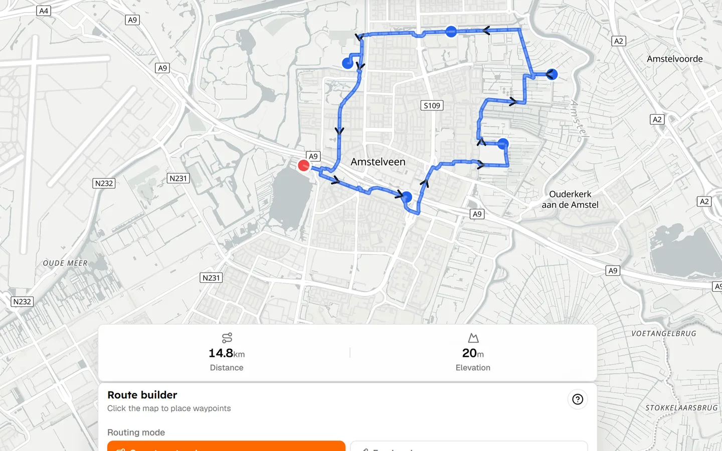
Open the map and treat it like any other ride: start point, waypoints, cycling-friendly roads, distance as you go. This e-bike route planner uses the same builder as every other Tailwind route — snap to roads or draw freehand — then scores the weather on top.
You can plan an electric bike route without creating an account, then save it when you want hourly scores.
02
Plan rides around your battery range
Distance and elevation are the practical range questions most e-bike riders already use. A 40 km route with 200 m of climbing is a different battery day from 80 km and 1,200 m. Tailwind shows those numbers while you plan so you can keep the ride inside what you know your bike can do.
Tailwind does not predict remaining battery, model consumption, or map charging stops. Specialist e-bike planners exist for that. If you need a battery calculator, use one. Then bring the GPX here to score wind and timing.
03
Check elevation before you ride
An e-bike makes hills easier. It does not make them free. Seeing the elevation profile before you leave still matters for assistance level, clothing, and whether the route is a sensible length for the day.
04
See the weather along your e-bike route
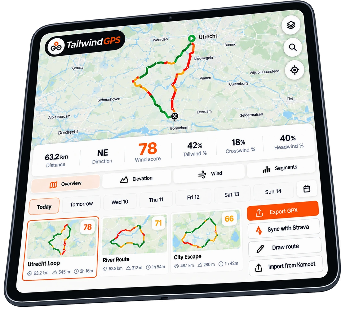
Motor or not, you are still a rider in the wind. Tailwind samples wind, rain and temperature along the electric bike route at your pace — including the higher average speed assistance can mean — so the forecast matches where you will be.
05
Find the best time to ride
An e-bike makes hills easier. It doesn't make a headwind disappear. Aerodynamic drag is still there; you just have a motor helping you punch through it, which costs range and still feels like work on an exposed road.
That is where Tailwind separates itself from dedicated e-bike route planners that obsess over battery maths. Scroll the hours. Ride when the wind is with you, or accept the slog with your eyes open.
06
Create, import or share an e-bike route
Draw on the map, upload GPX, or connect Strava. Share a link when you want someone else on the same ride. The e-bike trip planner part is the route plus the hour, not a touring itinerary with hotels.
07
Export GPX to your bike computer
Download GPX for a Garmin, Wahoo, or the computer already on your bars. Tailwind is the planning and weather layer; your head unit can still do the navigation.
08
Tailwind GPS vs dedicated e-bike route planners
Bikemap offers e-bike routing that can account for elevation and avoid steps. Specialist tools focus on battery consumption and charging. Outdoor planners increasingly sell elevation-as-range.
Tailwind does not compete on battery modelling. It owns e-bike route plus weather plus timing — the part a motor cannot solve for you.
| Capability | Tailwind | Bikemap / Komoot | Specialist e-bike |
|---|---|---|---|
| E-bike route planning | ✓ | ✓ | ✓ |
| GPX export | ✓ | ✓ | ✓ |
| Battery / charging model | — | Some | ✓ |
| Weather along route | ✓ | Limited | — |
| Best departure time | ✓ | — | — |
Free forever on 3 routes
Stop guessing. Ride with the wind.
- Every route scored for wind, rain and temperature
- The best hour to ride, up to 3 days out
- Strava routes in with one tap
Free forever on 3 routes. No card.
Keep planning with Tailwind GPS
Frequently asked questions
Is this an electric bike route planner?
Yes. You can plan an e-bike route on the map, import GPX, and export to a bike computer. Weather and the best time to ride are included. Battery prediction is not.
Does Tailwind calculate e-bike battery range?
No. Use distance and elevation as your planning checks, or a specialist battery tool if you need modelled consumption. Tailwind builds a Tailwind Score from wind, rain and temperature.
Do I still need to worry about wind on an e-bike?
Yes. A motor helps on climbs and into a breeze, but it does not remove aerodynamic drag. A headwind still costs effort and battery. That is why hourly route scoring still matters.
Can I use this for e-bike navigation?
Plan here, then navigate in the Tailwind browser or export GPX to your existing device. Tailwind is not a dedicated turn-by-turn e-bike computer replacement.
Can I import an e-bike trip as GPX?
Yes. Upload GPX or connect Strava, then score the route hour by hour like any other ride.
Hills get easier. Headwinds don't.
Plan an e-bike route free, then ride when the wind is actually on your side.