Tailwind GPS vs Weather Underground for cycling weather planning (2026)
Compare Tailwind GPS and Weather Underground for cyclists. See which app actually answers 'will this route feel fast today?', with route scoring, wind, and timing.

You check the forecast. It says "south-westerly 15 mph." You head out, turn right onto your usual loop, and spend the first hour grinding directly into a headwind the forecast technically mentioned, but never translated into what it actually meant for your ride. Sound familiar?
That's the gap this comparison is designed to address. Weather Underground and Tailwind GPS are both useful tools, but they answer different questions. One tells you what the weather is doing. The other tells you how that weather will affect your specific ride.
Quick verdict for cyclists
Weather Underground is a trusted, data-rich platform for local weather. Its network of over 250,000 personal weather stations (PWS) gives you genuinely granular, hyper-local conditions, and its hourly forecasts include wind speed, wind direction and precipitation probability at a given location. It's excellent for knowing whether to bother leaving the house.
Tailwind GPS is built for a different question entirely: "Should I ride this route today, and what time should I leave?" It samples conditions along every segment of your actual route, accounts for your riding speed and direction of travel, and collapses all of it into a single Tailwind Score (0–100) per departure hour. No wind arrows to interpret. No mental arithmetic.
| Feature | Weather Underground | Tailwind GPS |
|---|---|---|
| Hourly wind + rain at a location | Yes | Yes (along route) |
| Route-specific wind impact score | No | Yes (0–100 per departure hour) |
| GPX / Strava route import | No | Yes |
| Tailwind/headwind % breakdown | No | Yes |
| Departure-time comparison | No | Yes |
| Planning horizon | Up to 14 days | 3 days (free) / 14 days (subscriber) |
| Email alerts for best ride windows | No | Yes (subscriber) |
| Price | Free | Free / $2.99 per month |
What Weather Underground does well (in a cycling context)
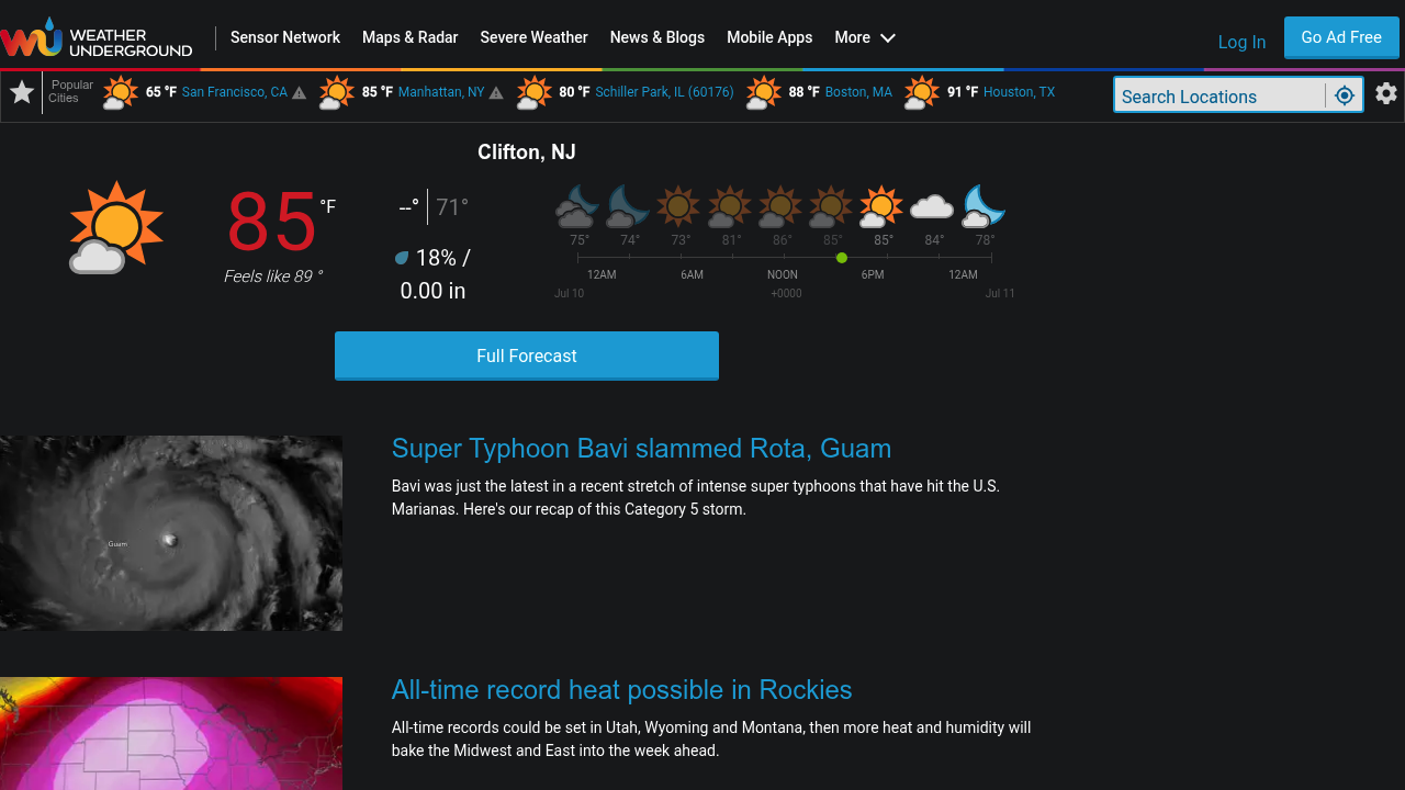
Weather Underground's strength is its density of local data. According to its own About Data documentation, it generates forecasts hourly and every three hours, powered by The Weather Company's high-resolution global modelling blended with readings from its enormous PWS network. That's genuinely useful when you want to know whether conditions near your start point are accurate, not just a regional estimate.
For cyclists, Weather Underground is worth using when:
- You want to decide whether to ride at all (is there a thunderstorm coming?)
- You need to know general rain risk before choosing kit
- You want a rough sense of wind speed and direction at a specific location
- You're checking historical conditions at a particular station for context
- You're planning a ride near a coastal or exposed location where a nearby personal weather station gives you better local data than a regional model
The hourly forecast pages, as shown on location-specific pages across the platform, give you a clear view of wind speed, wind gust, wind direction and precipitation probability at that location throughout the day. For deciding whether to pull on a rain jacket or swap to heavier wheels, that's entirely sufficient.
What Weather Underground doesn't do for route-specific cycling
Here's the problem cyclists run into. You're not stationary. A two-hour ride covers 40, 60, maybe 80 kilometres of road, passing through changing terrain and crossing wind from multiple directions as the route turns. A south-westerly that puts a headwind on your outbound leg becomes a tailwind on the return, but only if your route actually runs that way.
Weather Underground gives you conditions at a point. It doesn't know your route. There's no mechanism to upload a GPX file or import your Strava loop and see how the forecast translates along that specific path. The app will tell you the wind is blowing at 18 mph from the south-west. What it won't tell you is that your Tuesday evening loop heads south-west for the first 20 km, meaning you'll be riding directly into that wind for the most exposed section before it backs off when you turn north.
That interpretation is left entirely to you. And if you've ever mentally mapped wind arrows onto a route in your head, you know how unreliable that process is, especially on loops with multiple direction changes.
There's no Tailwind Score equivalent in Weather Underground. No single metric that answers "is this a good departure hour for this route?" No route-by-route comparison across your regular rides. For cyclists doing route-specific wind analysis, that's the core gap.
What Tailwind GPS is built to do instead
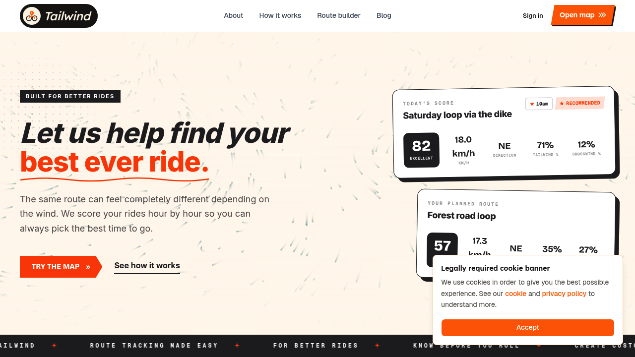
Tailwind GPS was built around one question: "Which ride will be amazing today?"
Every route you save is divided into individual segments. Hourly weather forecasts are sampled along each segment, taking into account wind direction, wind speed, temperature and rainfall. Your expected position on the route at every point in time (based on your average riding speed) is factored in too. All of that gets compressed into a single Tailwind Score for each departure hour on a 0–100 scale.
The score bands are:
- 80–100: Excellent. Expect favourable tailwinds for most of the ride
- 55–79: Great riding conditions
- 40–54: Neutral
- 20–39: Challenging
- 0–19: Prepare for a tough ride
You don't need to understand meteorology. You open the app, look at your routes, and pick the departure time with the best number. That's the whole workflow.
Free users get a three-day forecast window. Subscribers unlock 14-day cycling weather planning for $2.99/month or $19.99/year, which is genuinely useful if you're scheduling a weekend century ride, a club outing, or a training block around specific wind conditions.
Subscribers also get route-specific email alerts: when a favourite route hits a threshold score you've set, Tailwind GPS emails you. Weekly ride summaries highlight the best upcoming windows across your saved routes. You set your preferences once and stop checking forecasts every morning. On a practical level for anyone with limited time to ride, that's a meaningful time-saver.
You can connect your Strava account and your existing routes appear automatically. No rebuilding anything. GPX uploads and a route-drawing tool on the interactive map are also available if you prefer not to use Strava, or want to plan a new loop before adding it to your training rotation.
Head-to-head: five real cycling decisions
"Which departure time is best for my saved route today?"
With Weather Underground, you'd open the hourly forecast for your start location, note the wind speed and direction at each hour, and manually work out which departure avoids the worst exposure. That requires knowing your route's orientation well enough to convert compass directions into headwind or tailwind. Doable, but time-consuming and imprecise.
With Tailwind GPS, you open your saved route, scroll through departure hours, and pick the one with the highest score. The conversion from wind forecast to route impact has already happened.
"Will I hit rain during the ride?"
Weather Underground gives you precipitation probability at your location, per hour. That works well if your whole ride stays near home. On a longer loop that takes you 30 km away, rain risk at your start point isn't necessarily rain risk along the exposed section of your route 90 minutes in.
Tailwind GPS samples rain along your route rather than at a single pin, so the score factors in precipitation probability at the points where you'll actually be, not just where you started.
"How hard will the ride feel with headwinds?"
Weather Underground reports wind speed and direction. It can tell you 20 mph north-westerly. It won't tell you that 60% of your route faces north-west, meaning most of the ride is directly into that wind. Tailwind GPS gives you headwind, tailwind and crosswind percentages for the route as a whole, broken down per departure hour. That's a direct answer to how the ride will feel, not a forecast you have to interpret.
"How far ahead can I plan?"
Weather Underground generates forecasts up to 14 days ahead, per its About Data documentation. Tailwind GPS also reaches 14 days ahead, but only on the subscriber plan. Free users get three-day visibility. If you regularly plan rides more than a few days out (holiday rides, sportive prep, club days), the subscriber plan is where the planning horizon becomes genuinely competitive.
"I already use Strava, what's the workflow?"
Weather Underground has no Strava integration. It's a location-based service: you search a town, a postcode, or a station, and you get conditions there. Your Strava route library has no relevance to it.
Tailwind GPS connects directly to Strava. Your saved routes import automatically, each one gets scored by departure hour, and you can compare conditions across your whole route library at once. For anyone who already has their regular rides saved in Strava, that's the difference between a tool you'll use daily and one you'll occasionally consult.
If you want to see how that compares against other wind-aware cycling apps, there's a broader comparison available.
Which tool is right for you
These two tools aren't really competing for the same job. The choice depends on what question you're trying to answer.
Use Weather Underground if:
- You want detailed hyper-local conditions from a station near your home or riding area
- You're deciding on clothing, checking for lightning risk, or getting general wind context
- You want interactive radar and historical weather data for an area
- You're planning activities where your location stays relatively fixed
Use Tailwind GPS if:
- You want a single score that tells you whether your specific route will be fast or tough today
- You care about departure timing and want to compare multiple hours without manual interpretation
- You have regular Strava routes you want monitored automatically for good conditions
- You want alerts when your favourite loop hits a threshold score, rather than checking forecasts yourself
- You're planning rides up to 14 days ahead and want route-level detail, not just point forecasts
Honestly, the two tools complement each other well. Weather Underground for a quick sense of general conditions; Tailwind GPS for the specific routing and timing decision. You don't have to choose one and ignore the other. But if you've ever set off into an unexpected headwind after checking a forecast that technically had all the information you needed, Tailwind GPS is the tool that does the translation work for you.
For a deeper look at how Tailwind GPS compares against dedicated cycling apps, the Tailwind GPS vs Epic Ride Weather vs myWindsock comparison covers the route-scoring tools specifically.
Frequently asked questions
Can Weather Underground predict wind exactly along my route?
No. Weather Underground forecasts conditions at a location (or grid point / nearby PWS station). It doesn't accept route input, so it can't translate those conditions into headwind or tailwind percentages along a specific GPX path. You'd need to do that interpretation yourself based on your route's orientation.
Does Tailwind GPS replace weather apps?
No, and it doesn't try to. Tailwind GPS focuses on converting forecasts into route-specific ride scores. It doesn't provide radar imagery, storm tracking, or general local weather browsing. It sits alongside your existing weather tools and answers the question they can't: "how will this forecast actually affect my ride on this specific route?"
How accurate is wind-based ride planning?
All forecast-based tools carry inherent uncertainty, wind in particular can shift faster than models predict, especially in exposed or hilly terrain. Tailwind GPS works from the same underlying forecast data that other services use, but converts it into a route score rather than leaving you to interpret raw numbers. The accuracy of the prediction is forecast-limited; what Tailwind GPS adds is the translation step from weather data to ride impact.
Do I need a Strava account to use Tailwind GPS?
No. Strava integration is the quickest way to get started because your existing routes import automatically, but you can also upload GPX files directly or draw your own cycling route on the interactive map. The scoring and departure-time comparison features work the same way regardless of how you add your routes.
Is there a free version of Tailwind GPS?
Yes. The free plan includes up to three saved routes with a three-day forecast window, GPX import and export, Strava integration, route drawing and the interactive wind map. The subscriber plan (from $2.99/month) adds a 14-day planning window, up to 40 saved routes, weekly ride summaries and route-specific email alerts. See Tailwind GPS free plan details for the full breakdown.
Stop guessing whether the wind will be on your nose. Load your routes into Tailwind GPS, check the Tailwind Score by departure hour, and find your best ever ride.
Try it now
Connect Strava or upload a GPX and see route-specific scores for every departure hour.
Related posts

Introducing Ride Huddles: a simple way to choose your next group ride
Ride Huddle is a simple way for groups to choose a route together. Create a Huddle, add your routes, share one link, and let everyone vote — free, with no account required.
·2 min read

How to navigate a cycling route without getting lost
Stay on the line with in-browser turn-by-turn: voice prompts, navigate-to-start, and rerouting. Tailwind GPS is the phone navigation — export GPX only for a head unit.
·8 min read
How to plan a cycling route and navigate it on your phone
Plan a cycling route on your phone, pick the best hour, then start in-browser turn-by-turn. Tailwind GPS includes voice prompts, navigate-to-start, and rerouting.
·6 min read