Tailwind GPS vs Tempo Routes: the cycling route planning comparison you actually need (2026)
Tempo Routes is logistics software, not a cycling tool. Compare Tailwind GPS against the real wind-aware route planners: Epic Ride Weather, myWindsock, Headwind App, and more.

If you searched for "Tailwind GPS vs Tempo Routes" expecting a head-to-head between two cycling apps, you've hit a naming collision worth clearing up immediately. They're not competing in the same category at all.
What "Tempo Routes" actually is (and why names get messy)
"Tempo Routes" in search results points to enterprise logistics software: multi-stop route optimisation tools used by delivery fleets and dispatch teams to sequence stops and manage time windows. Think Mapotempo and similar products. Useful for courier operations. Completely irrelevant if you're trying to figure out whether the 7am or 9am departure will give you a tailwind on your favourite Saturday loop.
What most cyclists searching this phrase actually want is route-specific wind and weather forecasting with some kind of timing guidance: a tool that tells you when to leave and which route to ride based on wind direction relative to your specific roads. That's a different product category entirely.
So this comparison focuses on the tools that actually solve that problem. Tailwind GPS sits at the centre of that category, and below you'll find how it stacks up against the consumer cycling weather and wind apps that riders genuinely compare.
What cyclists actually need from a route weather tool
Generic weather apps give you wind speed at your postcode. That's rarely enough. A south-westerly at 20 km/h tells you almost nothing about whether your 60 km loop will feel good or terrible, because it depends entirely on which direction your roads run.
The non-negotiables for a proper cycling route weather tool:
- Route-aware wind. Headwind, tailwind, and crosswind calculated relative to each segment of your actual route, not just "wind from the south-west."
- Timing sensitivity. Wind direction and speed change by the hour. Leaving at 7am versus 10am on the same route can mean the difference between a tailwind homeward leg and a grinding headwind finish.
- Full-route forecasting. The tool needs to project conditions along the entire journey over time, not just at your start point.
- A decision layer. Ideally, the output isn't just data to interpret. It answers the question: should I ride this route today, and if so, when?
Most tools in this space handle the first three reasonably well. The fourth is where they diverge sharply.
Tailwind GPS: the route-specific Tailwind Score workflow
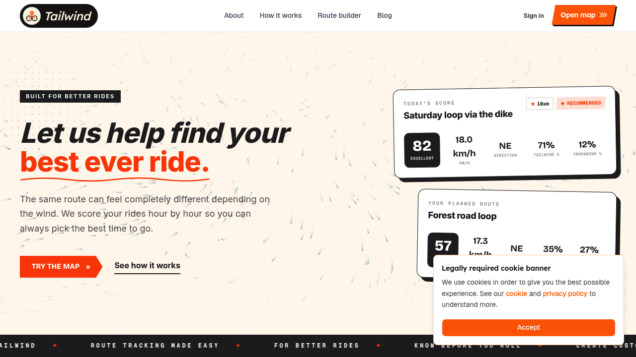
Tailwind GPS was built specifically around that fourth requirement. Every saved route receives a Tailwind Score from 0 to 100 for each departure hour. The score bands work like this:
| Score | What it means |
|---|---|
| 80–100 | Excellent. Favourable tailwinds for most of the ride. |
| 55–79 | Great riding conditions. |
| 40–54 | Neutral. |
| 20–39 | Challenging. |
| 0–19 | Expect a tough ride. |
The scoring isn't done at your front door. Tailwind GPS divides each route into segments, samples hourly weather forecasts (wind direction, wind speed, temperature, rain probability) at each point along the route, and weights everything by how long you'll actually spend on each section at your riding pace. That last part matters: a fast rider and a slower rider will be in different places on the route when the wind shifts, and the scoring reflects that personalisation.
Free users get 3-day forecasts and up to 3 saved routes. Subscribers unlock a 14-day planning window and up to 40 saved routes, plus route-specific email alerts and weekly ride summaries that flag the best conditions coming up. At $2.99/month or $19.99/year, the subscription tier is genuinely low-cost compared to most cycling app subscriptions.
For route import, you can connect your Strava account and existing routes load automatically, upload GPX files, or draw directly on the map. No app download required; it's web-first and works cleanly on mobile.
Where Tailwind GPS differs from the rest of the category
Most competitors in this space show you wind along your route. The experience is more interpretation than decision. You get a chart, a heatmap, or an animated map, and you decide what it means for your ride.
Tailwind GPS converts that analysis into a single, ranked score per departure hour. You don't need to understand pressure systems or read a wind rose. You glance at your saved routes, see which one scores highest at your preferred departure time, and go. The interactive wind map with animated wind particles is there if you want to dig deeper, but you're never required to.
That mobile-first simplicity is the core design choice. It's what makes Tailwind GPS a planning tool rather than a weather tool.
Tailwind GPS vs Epic Ride Weather
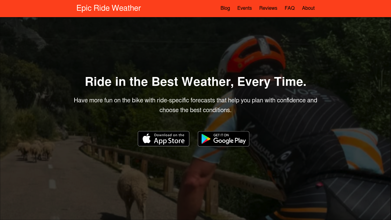
Epic Ride Weather claims "forecasts show wind, rain, and temperature minute-by-minute along your route" and helps you "pick the best time to ride." It integrates with Strava, Garmin, and Komoot, and has device integration with Hammerhead Karoo. Social proof from Team Visma adds credibility.
The minute-by-minute breakdown is genuinely detailed, and for riders who want granular data over a single departure, it's well-regarded. Where it falls short is that same interpretation gap: it shows you the data, but converting that into a clear "leave at 8am, not 10am" decision still requires reading the charts yourself.
Tailwind GPS's one-score-per-departure-hour workflow is faster for the everyday rider who just wants an answer. Epic Ride Weather is a good Epic Ride Weather alternative reference point for those wanting depth, but Tailwind wins on decision speed.
Tailwind GPS advantage: single score per departure hour, 14-day window, alerts, no interpretation required. Epic Ride Weather advantage: minute-by-minute granularity, device integration (Hammerhead Karoo).
Tailwind GPS vs myWindsock
myWindsock describes itself as offering "on-road wind modelling" and a "rebuilt route planner with live weather." Its feature depth appeals to power users: proprietary metrics, advanced charts, and a strong integrations list covering Strava, Garmin, Wahoo, Ride With GPS, and Komoot.
The trade-off is complexity. The route planner page reads more like a UI reference than a guided tool. If you're comfortable with cycling data and want to extract maximum detail, myWindsock delivers. If you're a recreational rider wanting to quickly compare a Tuesday evening spin against Thursday morning, the cognitive overhead is higher than it needs to be.
This is where Tailwind GPS wins for the majority. You don't need a glossary to read a score of 78 for the 7am slot and 41 for the 10am slot.
Tailwind GPS advantage: beginner-friendly UX, score bands, departure-time comparison without chart interpretation. myWindsock advantage: advanced metrics for data-oriented riders, power model integrations.
Tailwind GPS vs Headwind App
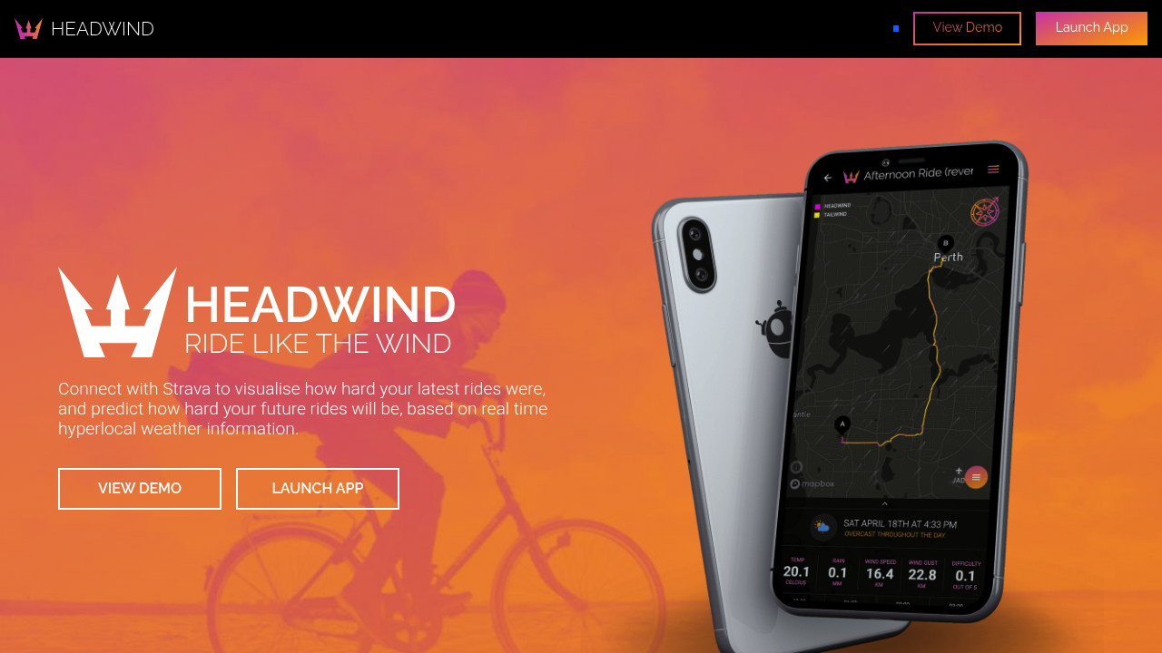
Headwind App uses Dark Sky for hyperlocal weather data and produces a difficulty score out of 5. It includes route heatmaps for head/tail wind segments and claims forecast horizons up to 7 days. Wind-adjusted calorie estimates and commuter planning are highlighted use cases.
The 1–5 difficulty scoring is conceptually similar to Tailwind's 0–100 approach, but the resolution is lower. "3 out of 5 difficult" is less actionable than comparing an exact score of 62 at 7am against 48 at 9am when you're deciding how to use a 2-hour training window. The heatmaps are a visual strength, though pricing transparency and methodology detail are thin on the landing page.
For training effectively in headwinds, Tailwind GPS's dedicated Headwind Training mode goes further: it deliberately surfaces rides with sustained headwinds, so you can seek them out rather than just tolerate them.
Tailwind GPS advantage: higher-resolution scoring, 14-day window, Headwind Training mode, transparent free plan. Headwind App advantage: heatmap visualisation, wind-adjusted calorie estimates for commuters.
Tailwind GPS vs Komoot Premium weather
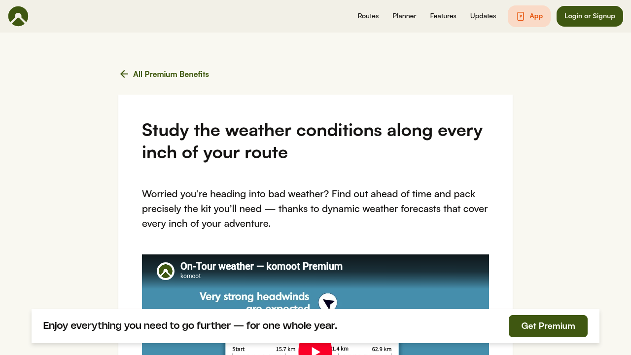
Komoot Premium promises to let you "study the weather conditions along every inch of your route" with pack/prepare prompts and strong visual storytelling. It's a general-purpose route platform that layers weather on top as a Premium feature.
For riders already embedded in the Komoot ecosystem, the weather overlay is a natural addition. But Komoot is primarily a route discovery and navigation platform. Its weather layer answers "what will it be like on this specific route?" rather than "which of my five regular routes is best to ride at which time?" The scoring and multi-route departure-time comparison that Tailwind GPS provides isn't what Komoot is built for.
Tailwind GPS advantage: wind-first, cycling-specific scoring, multi-route comparison, 14-day departure-time optimisation. Komoot Premium advantage: strong navigation, turn-by-turn directions, route discovery, existing ecosystem.
Tailwind GPS vs Routeweather
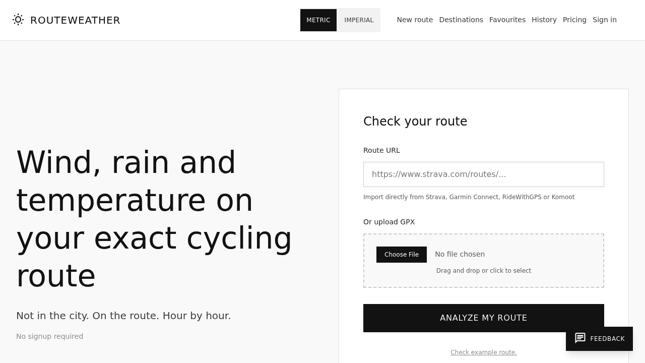
Routeweather offers "wind, rain and temperature on your exact cycling route" with a "no signup required" entry point. You upload a GPX file or paste a route link, choose your start time, and see the output. There's a live example and basic FAQs. For a one-off route check before a sportive or unfamiliar ride, it's genuinely low-friction.
The limitations show up over time. Without an account, there's no persistent route library, no personalisation to your pace, no departure-time comparison across multiple days, and no alerting. You get a single snapshot, not an ongoing planning tool. Routeweather is fine for a one-off check; Tailwind GPS is the better fit for riders who want to plan their regular routes across the coming fortnight.
Tailwind GPS advantage: saved routes, 14-day forecasts, personalised scoring, weekly alerts, no repeated uploads. Routeweather advantage: zero signup friction for a single one-off check.
Garmin wind data fields (MOGUWIND and SRT Wind) vs Tailwind GPS
These two Garmin Connect IQ fields solve a different problem entirely, which is worth clarifying if you've come across them during your search.
MOGUWIND describes itself as: "You see the wind. In real time. Kilometre by kilometre." It displays headwind/tailwind and crosswind components (H/T and CROSS fields) on your Garmin device during a ride, using Open-Meteo as primary data with Garmin Weather as fallback. Post-ride data is recorded in Garmin Connect for analysis.
SRT Wind takes a 3-panel layout approach showing absolute wind, speed, and relative wind, with colour-coded stress levels and numeric thresholds.
Both are useful for on-bike awareness. Neither is a pre-ride route planning tool. You can't use them to compare departure times, save multiple routes, get a 14-day forecast, or receive alerts when conditions improve. They answer "what's the wind doing right now?" not "should I have left an hour earlier and taken the other route?"
The sensible pairing: plan your departure time and route in Tailwind GPS, then use a Garmin wind field during the ride if you want real-time wind data on your head unit. They're complementary, not competing.
Full feature comparison at a glance
| Feature | Tailwind GPS | Epic Ride Weather | myWindsock | Headwind App | Routeweather | Garmin fields |
|---|---|---|---|---|---|---|
| Route-specific wind score | 0–100 per hour | Chart/visual | Chart/visual | 1–5 difficulty | Chart/visual | Real-time only |
| Planning horizon | 3 days (free) / 14 days (sub) | Not published on page | Not published on page | Up to 7 days | Start-time snapshot | Live only |
| Departure-time comparison | Yes, per hour | Yes | Yes | Limited | Choose one time | N/A |
| Strava sync | Automatic | Yes | Yes | Yes | GPX upload only | N/A |
| Personalised to rider pace | Yes | Not stated | Partial (wattage) | Not stated | Not stated | N/A |
| Headwind training mode | Yes | No | No | No | No | N/A |
| Email alerts | Yes (subscriber) | No (page unclear) | No (page unclear) | No | No | N/A |
| No signup required | No (free plan) | App download | Yes (free) | App download | Yes | App install |
| Pricing transparency | Clear on site | Not on landing page | Not on landing page | Not on landing page | Not on landing page | Free field |
Which one should you choose?
The right tool depends on what you're actually trying to do:
You want logistics/dispatch software: Tempo Routes and similar multi-stop optimisation tools are the right category. Cycling weather apps won't help you here.
You want to choose the best departure time and route for your regular rides: Tailwind GPS is the strongest fit. The Tailwind Score removes the interpretation work, the 14-day window lets you plan around work and family schedules, and Strava sync means your routes are already waiting without rebuilding anything.
You want maximum data depth and you're comfortable reading charts: myWindsock or Epic Ride Weather will satisfy a data-oriented rider who enjoys the granularity.
You want weather overlays inside a navigation app you already use: Komoot Premium layers route weather on top of a platform built for navigation and route discovery.
You want on-bike wind data during the ride, on your Garmin head unit: MOGUWIND or SRT Wind handle that use case. Pair with Tailwind GPS pre-ride for full coverage.
You want a one-off check with zero signup: Routeweather handles that quickly.
For most recreational cyclists with limited riding windows and a handful of regular routes, the combination of a route-specific score, hourly departure comparison, and a 14-day planning horizon makes Tailwind GPS the most practical everyday tool in the category.
FAQ
Do I need to understand meteorology or wind roses to use Tailwind GPS? No. The Tailwind Score is designed so you don't need any weather knowledge. A score of 82 at 7am means go. A score of 31 at 10am means expect a tough ride. That's all the interpretation required.
How far ahead can I plan? Free users see 3 days ahead. Subscribers unlock up to 14 days ahead, which covers most training windows and weekend planning cycles.
Does Tailwind GPS use my riding speed to calculate the score? Yes. You set your average riding speed in your preferences, and the scoring weights where you'll actually be on the route at each point in time. A faster rider and a slower rider will encounter the same weather at different points in the ride, and the score reflects that.
Does it work with my Strava routes? Connect your Strava account and your saved routes import automatically. You can also sync Strava routes for wind scores without rebuilding anything from scratch. GPX upload and drawing directly on the map are also supported.
Will other apps show wind along the route? Yes. Epic Ride Weather, myWindsock, Routeweather, and Headwind App all display wind conditions along a route. The difference is whether the tool converts that data into a single ranked score per departure hour or leaves the interpretation to you. Tailwind GPS does the former.
Is "Tempo Routes" actually a cycling tool? No. In public search results, Tempo Routes refers to enterprise logistics and multi-stop route optimisation software, not consumer cycling weather planning. If you're looking for route-specific wind forecasting and departure-time scoring for cycling, that's a different category entirely, and this comparison covers the tools that serve it.
The question every cyclist with limited time needs answered is simple: should I ride this route today, and when should I leave? Tailwind GPS is built to answer that question clearly, without requiring you to become a weather analyst to do it. Connect your Strava account, glance at the scores, and ride when the numbers are on your side.
Try it now
Import your Strava routes and compare hourly Tailwind Scores across the next 14 days.
Related posts

Introducing Ride Huddles: a simple way to choose your next group ride
Ride Huddle is a simple way for groups to choose a route together. Create a Huddle, add your routes, share one link, and let everyone vote — free, with no account required.
·2 min read
How to navigate a cycling route without getting lost
Stay on the line with in-browser turn-by-turn: voice prompts, navigate-to-start, and rerouting. Tailwind GPS is the phone navigation — export GPX only for a head unit.
·8 min read
How to plan a cycling route and navigate it on your phone
Plan a cycling route on your phone, pick the best hour, then start in-browser turn-by-turn. Tailwind GPS includes voice prompts, navigate-to-start, and rerouting.
·6 min read