Tailwind GPS vs cycle.travel: which UK cycling app should you open first?
Tailwind GPS vs cycle.travel compared for UK cyclists. See which app wins for quiet roads, wind forecasting, departure timing, GPX export, and more.

Two tools, two very different questions. Before comparing Tailwind GPS and cycle.travel feature by feature, it's worth asking yourself what you're actually trying to solve. Are you trying to find quieter, safer roads for your ride? Or are you trying to work out when to leave so the wind is with you rather than against you?
The honest answer is that these tools aren't really competing for the same job. But if you're a UK cyclist wondering which one to open first, this comparison will give you a clear decision framework.
Quick verdict: which should you open first?
If you need to find a route that avoids busy roads and major traffic, open cycle.travel. It's built specifically for quiet-road routing and traffic-free cycleways across the UK.
If you already know your route (or have a favourite loop) and want to know whether the wind will be with you at 7am or 9am, open Tailwind GPS. It answers one question better than anything else: given the routes I already ride, when should I go?
If you want both, the two-step workflow is this: use cycle.travel to plan or export a quiet route, then load that route into Tailwind GPS to score it by departure hour and find your best riding window.
What cycle.travel is best at
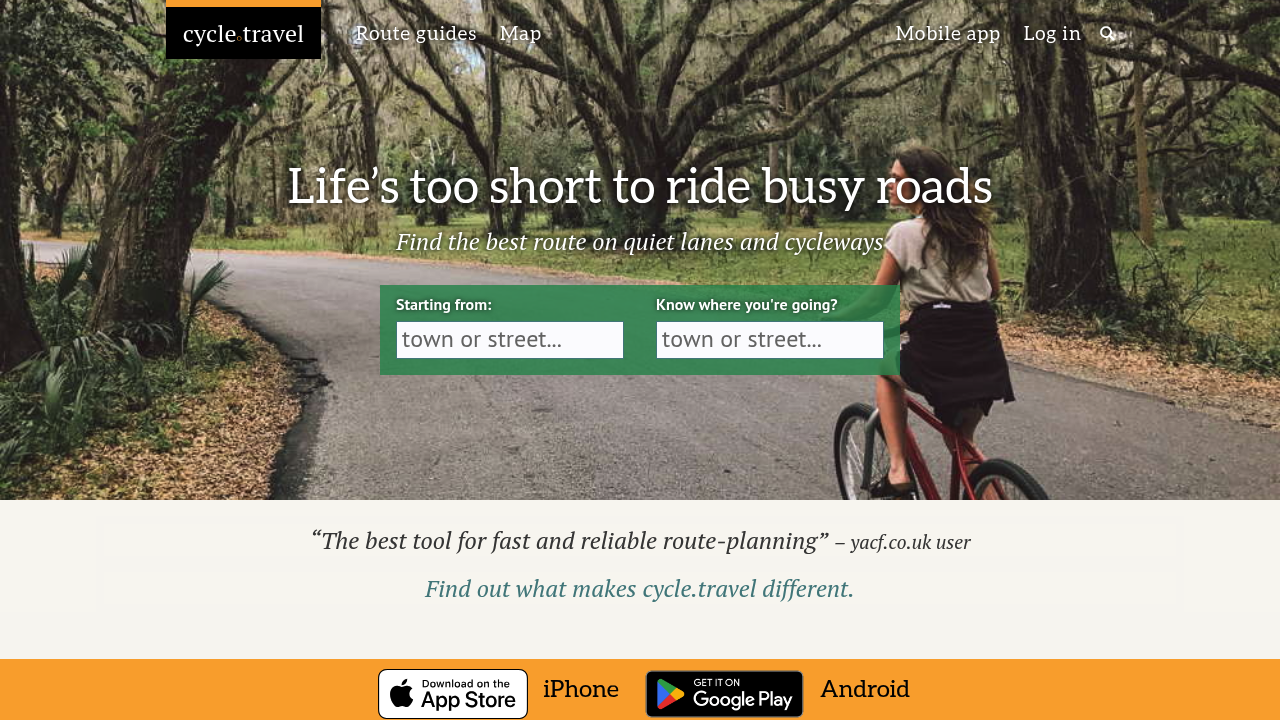
cycle.travel positions itself clearly: "Life's too short to ride busy roads!" Its tagline alone tells you what it optimises for. The planner finds routes on quiet lanes and traffic-free cycleways, which makes it particularly useful if you're planning rides in areas you don't know well, or if your goal is to reduce road-traffic exposure.
The route-type selection is one of its strongest features. According to cycle.travel's own FAQ, there are five route options: Any (standard), Paved, Gravel, EuroVelo, and Night. Choosing Gravel, for example, will route you away from tarmac and towards bridleways and off-road paths. Choosing Night will prioritise routes with less traffic during darker hours. That level of road-surface and time-of-day routing is genuinely useful for commuters, families, and gravel riders.
Once you've planned a route, the practical workflow is: set your start and destination, let cycle.travel find the best route, then push it to the app for turn-by-turn and offline navigation. For those using GPS computers, cycle.travel supports GPX track export, allowing you to download a GPX file and load it onto a Garmin, Wahoo, or similar device. TCX export is also available for Garmin Connect users.
What cycle.travel doesn't do is wind forecasting. There's no departure-time scoring, no hourly wind analysis along the route, and no way to know whether riding at 6am versus 10am will make a meaningful difference to your experience. That's where Tailwind GPS picks up.
What Tailwind GPS is best at
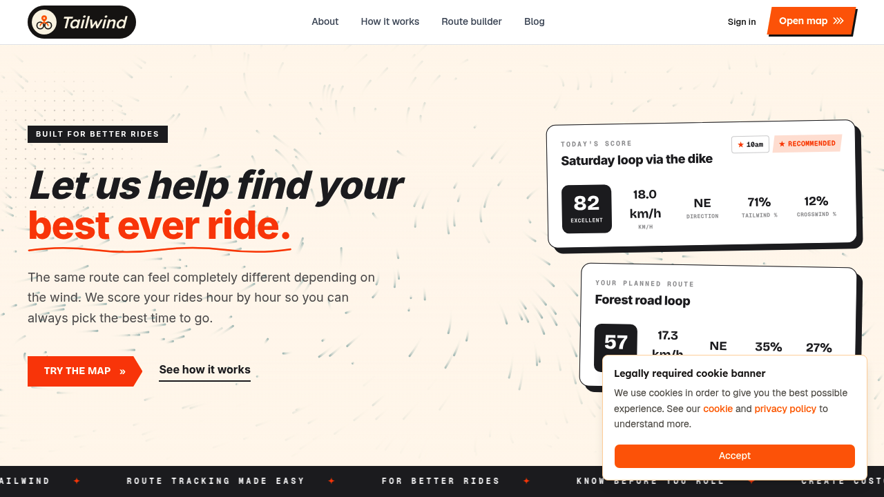
Tailwind GPS exists to help you find your best ever ride. The core idea is a Tailwind Score (0-100) for every departure hour, calculated from route-specific wind and weather data rather than a single-point forecast. Score bands work as follows: 80-100 is excellent (favourable tailwinds for most of the ride), 55-79 is great, 40-54 is neutral, 20-39 is challenging, and 0-19 means you should probably prepare for a tough outing.
The thing that makes this genuinely different from checking the BBC Weather app is that Tailwind GPS analyses conditions along every kilometre of your actual route, hour by hour, up to 14 days ahead. A westerly wind means something completely different on a north-south loop versus an east-west one, and the score accounts for that. It also factors in your average riding speed, so the forecast reflects where you'll actually be on the route at each point in time, not where someone riding 5 km/h faster or slower would be.
For UK cyclists with limited riding windows, the departure-time planning feature is particularly useful. You might have a two-hour window on a weekday evening and want to know whether 5:30pm or 7pm is the better bet. Tailwind GPS answers that directly.
Getting started is fast. Connect your Strava account and your existing routes appear automatically, already scored. You can also upload GPX files, draw routes on the interactive map, or export routes to your GPS computer. Free users get access to up to 3 saved routes with a 3-day forecast. Subscribers unlock up to 40 saved routes and a full 14-day planning window for $2.99/month or $19.99/year.
Subscribers also receive weekly ride summary emails, route-specific email alerts when a favourite route hits your chosen score threshold, wind score notifications, and rain alerts during your preferred riding hours. For anyone who wants to stop checking the forecast every morning, the alert system does that job for you.
There's also a Headwind Training mode for riders who want to use wind resistance deliberately. Rather than avoiding headwinds, this mode highlights rides where you'll face sustained headwinds, which is useful for building strength and endurance without needing specific training infrastructure.
Side-by-side comparison
| Feature | cycle.travel | Tailwind GPS |
|---|---|---|
| Route-finding on map | Yes, full planner | Yes, route builder + snap-to-roads |
| Quiet-road / traffic-free routing | Core feature | Not the focus |
| Wind & rain forecast by route | No | Yes, every km, hour by hour |
| Departure-time scoring | No | Yes, 0-100 score per hour |
| Scoring model | N/A | Tailwind Score, personalised to your speed |
| Route-specific alerts | No | Yes (subscribers) |
| Multi-day / touring workflow | Yes, route splitting | Up to 14-day forecast window |
| Turn-by-turn / offline navigation | Yes, via app | Yes (browser, online); no offline |
| GPX export | Yes | Yes |
| TCX export | Yes | Not confirmed |
| Strava integration | Not confirmed | Yes, auto-imports routes |
| Free plan | Free to use | Up to 3 routes, 3-day forecast |
| Paid plan | Free (app may have costs) | $2.99/month or $19.99/year |
Where they overlap, and how to combine them
Both tools let you plan on a map and export GPX files. That overlap is actually the bridge between them.
The cleanest combined workflow for UK cycle route planning is:
- Use cycle.travel to build a quiet, traffic-free route you're happy with.
- Export the GPX file from cycle.travel.
- Import that GPX file into Tailwind GPS.
- Check the Tailwind Score across different departure hours and pick your best window.
- Export the final route to your GPS computer for turn-by-turn navigation.
This two-step approach gives you the best of both tools: quiet roads from cycle.travel and route-specific wind forecasting from Tailwind GPS. There's no direct integration between the two platforms, so the GPX file is the practical bridge. It takes an extra two minutes and is well worth it for longer rides where conditions matter.
If you already have regular routes saved in Strava, you can skip the cycle.travel step and go straight to Tailwind GPS via the Strava sync, which pulls in your existing routes automatically.
Best use-cases: pick your scenario
Not every ride needs both tools. Here's how to think about which one to reach for:
You have a narrow weekday window and want to know when to leave. Open Tailwind GPS. Scroll through the departure hours, find the best Tailwind Score for your usual route, and head out at the right time. cycle.travel won't help you here.
You're planning a family ride or a club social where safety matters most. Open cycle.travel first. The quiet-road routing reduces traffic exposure significantly, especially on routes you don't know well. Run the final route through Tailwind GPS afterwards to avoid an unexpected headwind.
You're exploring new gravel terrain. Use cycle.travel's Gravel route type to find appropriate off-road paths, then check Tailwind GPS for conditions. Wind and rain matter more on exposed gravel terrain than on sheltered lanes.
You're doing a structured training block and want resistance. Use Tailwind GPS's Headwind Training mode to deliberately find routes and hours where you'll face sustained headwinds. Useful for building strength without searching for hills.
You're planning a multi-day touring trip. cycle.travel is better here, with route-splitting tools designed for breaking long journeys into daily stages. Pair it with Tailwind GPS's 14-day forecast to time each day's start for the best conditions.
You want to avoid headwinds entirely on a UK ride. Tailwind GPS is the right tool. The score tells you which departure hour minimises headwind exposure across your whole route, not just at your front door.
FAQs
Does cycle.travel include wind or headwind scoring? Not as a core feature. cycle.travel focuses on road type, traffic quietness, and surface, rather than departure-time wind analysis. If you want to know how wind will affect your ride hour by hour, you need Tailwind GPS.
Does Tailwind GPS replace a navigation app? Not for offline riding. Tailwind GPS includes browser-based turn-by-turn navigation with voice prompts when you have a signal, plus GPX export for Garmin and Wahoo head units. For areas with no coverage, a dedicated offline navigation app or GPS computer is still the better choice. Tailwind's core strength is scoring your route by conditions and telling you when to leave.
Can you export routes as GPX for a cycle computer? Yes from both. cycle.travel lets you download a GPX track file for use on a GPS unit. Tailwind GPS also supports GPX import and export, plus route sharing via a simple link. The interactive route planner map makes it straightforward to draw, export, and share.
Do both tools work for UK routes? cycle.travel is UK-focused and has strong coverage of UK cycling infrastructure, quiet lanes, and national cycling routes. Tailwind GPS works globally wherever cycling routes exist, using route-specific weather forecasting that's equally applicable to UK rides.
Which tool is best if you want to avoid headwinds entirely? Tailwind GPS. The wind scores for your Strava routes are calculated across your whole route, not just at one point, so you get a genuine picture of how wind direction intersects with your specific loop. cycle.travel doesn't provide this.
The decision checklist
So, which should you open first? It comes down to three options:
- Prioritise quiet roads: Open cycle.travel, use its route types to avoid traffic, export GPX when done.
- Prioritise best conditions: Open Tailwind GPS, check your saved routes for the best departure hour, set up alerts so you know when conditions are ideal.
- Want both: Use cycle.travel to plan the route, export as GPX, import into Tailwind GPS, then check departure-hour scores before you ride.
For most UK cyclists with regular routes already in Strava, the fastest path to better rides is connecting to Tailwind GPS, letting it score your existing loops, and using that data to choose when to leave. The free plan covers three routes and three days of forecasts. That's enough to see immediately whether this changes how you plan.
Try it now
Score your Strava routes by departure hour, or import a GPX from cycle.travel and check the best riding window.
Related posts

Introducing Ride Huddles: a simple way to choose your next group ride
Ride Huddle is a simple way for groups to choose a route together. Create a Huddle, add your routes, share one link, and let everyone vote — free, with no account required.
·2 min read

How to navigate a cycling route without getting lost
Stay on the line with in-browser turn-by-turn: voice prompts, navigate-to-start, and rerouting. Tailwind GPS is the phone navigation — export GPX only for a head unit.
·8 min read
How to plan a cycling route and navigate it on your phone
Plan a cycling route on your phone, pick the best hour, then start in-browser turn-by-turn. Tailwind GPS includes voice prompts, navigate-to-start, and rerouting.
·6 min read